


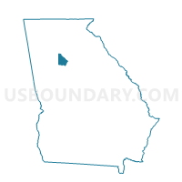
089LB - LAVISTA ROAD Voting District, DeKalb County, Georgia
About
Outline

Summary
| Unique Area Identifier | 561252 |
| Name | 089LB - LAVISTA ROAD Voting District |
| County | DeKalb County |
| State | Georgia |
| Area (square miles) | 1.10 |
| Land Area (square miles) | 1.09 |
| Water Area (square miles) | 0.01 |
| % of Land Area | 99.13 |
| % of Water Area | 0.87 |
| Latitude of the Internal Point | 33.81314240 |
| Longtitude of the Internal Point | -84.31588920 |
Maps


Graphs
Select a template below for downloading or customizing gragh for 089LB - LAVISTA ROAD Voting District, DeKalb County, Georgia


Neighbors
Neighoring Voting District (by Name) Neighboring Voting District on the Map
- 089BC - BRIAR VISTA ELEMENTARY Voting District, DeKalb County, GA
- 089BG - BRIARCLIFF Voting District, DeKalb County, GA
- 089CJ - CLAIRMONT HILLS Voting District, DeKalb County, GA
- 089CW - CORALWOOD Voting District, DeKalb County, GA
- 089DH - DRUID HILLS HIGH SCHOOL Voting District, DeKalb County, GA
- 089ER - EMORY ROAD Voting District, DeKalb County, GA
- 089LC - LAVISTA Voting District, DeKalb County, GA
- 089SA - SAGAMORE HILLS Voting District, DeKalb County, GA
Top 10 Neighboring County Subdivision (by Population) Neighboring County Subdivision on the Map
Top 10 Neighboring Place (by Population) Neighboring Place on the Map
Top 10 Neighboring Unified School District (by Population) Neighboring Unified School District on the Map
Top 10 Neighboring State Legislative District Lower Chamber (by Population) Neighboring State Legislative District Lower Chamber on the Map
- State House District 57, GA (51,069)
- State House District 83, GA (50,049)
- State House District 80, GA (48,878)
Top 10 Neighboring State Legislative District Upper Chamber (by Population) Neighboring State Legislative District Upper Chamber on the Map
Top 10 Neighboring 111th Congressional District (by Population) Neighboring 111th Congressional District on the Map
Top 10 Neighboring Census Tract (by Population) Neighboring Census Tract on the Map
- Census Tract 224.02, DeKalb County, GA (5,823)
- Census Tract 215.04, DeKalb County, GA (5,708)
- Census Tract 216.03, DeKalb County, GA (5,145)
- Census Tract 215.02, DeKalb County, GA (4,232)
- Census Tract 216.02, DeKalb County, GA (4,172)
- Census Tract 215.03, DeKalb County, GA (3,860)
- Census Tract 216.04, DeKalb County, GA (3,132)
Top 10 Neighboring 5-Digit ZIP Code Tabulation Area (by Population) Neighboring 5-Digit ZIP Code Tabulation Area on the Map
- 30033, GA (30,763)
- 30329, GA (28,539)
- 30324, GA (24,267)
- 30345, GA (23,129)
- 30306, GA (22,246)
- 30322, GA (2,023)